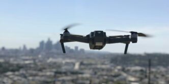

Drones are changing things fast. They’re not just toys anymore; they’re becoming super important tools in all sorts of jobs. From getting packages to your door to checking out construction sites, these flying robots are getting smarter and more capable every day. This article will look at how far UAV technology has come and what’s next for these amazing machines.
Key Takeaways
- Drones are getting way better at flying themselves, using things like AI and cameras to understand their surroundings.
- UAVs are changing how stuff gets delivered and how supply chains work, especially with new 5G networks.
- Planning drone flights is getting more advanced, allowing for smarter routes and better coverage.
- Drones are making construction and infrastructure projects safer and more efficient through automated checks and 3D mapping.
- Collecting data with drones is becoming incredibly precise, with high-resolution maps and detailed inspections.
Advancements in Autonomous UAV Navigation
Okay, so drones are getting smarter, like way smarter. It’s not just about remote control anymore; we’re talking about drones that can basically fly themselves, figure out where they are, and make decisions on the fly (pun intended, I guess). It’s pretty wild when you think about it.
Real-Time Environmental Awareness
Imagine a drone that doesn’t just follow a GPS route but actually sees what’s around it. That’s what we’re getting at with real-time environmental awareness. Drones are now equipped with sensors and cameras that allow them to perceive their surroundings in detail. This means they can react to unexpected obstacles, changing weather, and other dynamic conditions. It’s like giving them a pair of eyes and a brain to process what they see. For example, onboard sensors are getting better all the time.
AI-Powered Visual Navigation
This is where things get really interesting. We’re not just talking about obstacle avoidance; we’re talking about drones that can understand what they’re seeing. AI algorithms are used to interpret visual data, allowing drones to identify objects, track targets, and even create maps of their environment. It’s like teaching a drone to "see" and "understand" the world around it. The University of Missouri is doing some cool stuff with autonomous visual navigation, pushing the limits of what these things can do.
Adaptive Route Planning
So, the drone can see, and it can understand. Now, it needs to figure out where to go. Adaptive route planning means that the drone can adjust its flight path in real-time based on the information it’s gathering. If there’s a sudden obstacle, it can reroute itself. If the wind changes, it can adjust its course. It’s all about making the drone as flexible and responsive as possible. Simultaneous Localization and Mapping (SLAM) helps with this, letting the drone create a real-time map and track its position.
Transforming Logistics with UAV Technology
UAVs are making a big splash in how stuff gets from point A to point B. It’s not just about getting packages to your door faster; it’s about completely rethinking how supply chains work. Think about it: fewer trucks on the road, quicker deliveries to remote areas, and a whole lot less waiting around. It’s a pretty exciting time for logistics operations.
Last-Mile Resupply Innovations
Last-mile delivery is always a pain, right? It’s the most expensive and time-consuming part of the whole process. But UAVs? They can change that. Imagine drones dropping off packages directly to customers’ homes, bypassing traffic jams and other delays. We’re talking about faster delivery times and lower costs. Plus, it opens up possibilities for delivering to places that are hard to reach by traditional methods. It’s not just about convenience; it’s about making deliveries more efficient and accessible for everyone.
Enhanced Efficiency in Supply Chains
It’s not just the last mile that benefits. UAVs can also make the entire supply chain run smoother. Think about using drones to monitor inventory levels in warehouses, inspect equipment, or even transport goods between different facilities. This can lead to:
- Reduced transportation costs
- Improved inventory management
- Faster turnaround times
It’s all about optimizing every step of the process to boost future growth and get things where they need to be, when they need to be there.
Integration of 5G Networks
5G is a game-changer for UAV logistics. With faster speeds and lower latency, 5G networks enable real-time communication and data transfer between drones and control centers. This means:
- More precise navigation
- Improved safety
- Better coordination of drone fleets
It’s like giving drones a super-fast internet connection, allowing them to operate more efficiently and reliably. This is especially important for complex operations like delivering medical supplies or inspecting critical infrastructure. The perishable goods transportation market is about to get a whole lot faster.
The Future of UAV Flight Planning
Okay, so flight planning for UAVs is getting seriously interesting. It’s not just about drawing a straight line on a map anymore. We’re talking about drones that can think for themselves, adapt to changing conditions, and make decisions on the fly. It’s a bit like teaching a bird to navigate, but with algorithms and sensors instead of instinct. I think the future of UAV technology is going to be wild.
Adaptive Pattern Generation
Imagine a drone that can adjust its flight path in real-time based on what it sees. That’s the idea behind adaptive pattern generation. Instead of following a pre-programmed route, the drone uses sensors and AI to identify features and modify its path accordingly. For example, if it spots an unexpected obstacle, it can automatically reroute to avoid it. Or, if it detects a higher concentration of something it’s monitoring (like pollution), it can adjust its pattern to focus on that area. It’s all about flexibility and responsiveness.
Multi-Objective Optimization
Flight planning isn’t just about getting from point A to point B. There are often multiple goals to balance, like time, quality of data, and battery life. Multi-objective optimization is about finding the best compromise between these competing priorities. For example, a drone might need to cover a large area quickly, but also collect high-resolution images. Or it might need to minimize flight time to conserve battery, but also avoid flying over populated areas. It’s a complex balancing act, and it requires sophisticated algorithms to find the optimal solution.
Geospatial Foundations for Flight
At the heart of all this advanced flight planning is geospatial data. Drones need accurate maps and location information to navigate effectively. This includes everything from basic terrain data to detailed 3D models of buildings and infrastructure. The better the geospatial data, the better the drone can plan its flight and avoid obstacles. Plus, with the rise of precision aerial photogrammetry, we can create even more detailed and accurate maps, which in turn enables even more sophisticated flight planning. It’s a virtuous cycle of improvement.
UAVs in Construction and Infrastructure
UAVs are changing how construction and infrastructure projects are handled. It’s not just about taking cool pictures from above; it’s about making things safer, faster, and more efficient. Think about it: instead of sending someone up on scaffolding to inspect a bridge, you can send a drone. That’s a big deal.
Automated Inspection and Monitoring
Drones are becoming essential for automated inspection and monitoring on construction sites. They can fly pre-programmed routes, capturing high-resolution images and videos to track progress and identify potential problems early on. This means fewer surprises and better project management. For example, drones can monitor material stockpiles, track equipment locations, and ensure safety compliance. It’s like having a constant eye in the sky, providing real-time data to project managers.
3D Mapping and Surveying Applications
Forget traditional surveying methods that take days or weeks. Drones equipped with LiDAR and photogrammetry technology can create detailed 3D maps and surveys of construction sites in a fraction of the time. This data is super useful for planning, design, and progress tracking. Plus, it’s way safer than sending surveyors into hazardous areas. Site surveying is now faster and more accurate than ever before.
AI and Digital Twin Integration
AI and digital twins are taking UAV applications in construction to the next level. Drones collect data, AI analyzes it, and digital twins provide a virtual replica of the construction site. This allows project managers to simulate different scenarios, optimize workflows, and identify potential issues before they become costly problems. It’s like having a crystal ball for construction, helping to make smarter decisions and avoid costly mistakes. Imagine being able to predict structural issues before they even happen! That’s the power of AI and digital twin integration.
Here’s a simple example of how data from drones can be used to update a digital twin:
| Data Source | Type of Data | Use in Digital Twin |
|---|---|---|
| Drone Imagery | High-resolution photos | Visual updates, progress tracking |
| LiDAR Scans | 3D point clouds | Accurate site modeling, volume calculations |
| Thermal Cameras | Temperature readings | Identifying heat loss, structural issues |
Revolutionizing Data Collection with UAVs
UAVs are changing how we gather information, plain and simple. It’s not just about taking pictures from the sky anymore. We’re talking about detailed, actionable data that can transform industries. The ability to collect data quickly, safely, and efficiently is what makes UAVs so revolutionary.
High-Resolution Semantic 3D Maps
Forget traditional maps. UAVs equipped with advanced sensors can create high-resolution semantic 3D maps. These aren’t just pretty pictures; they’re data-rich models that understand the environment. Think about city planning, disaster response, or even autonomous vehicle navigation. The level of detail is insane. For example, you can use drone data processing to create these maps.
Precision in Aerial Photogrammetry
Aerial photogrammetry has been around for a while, but UAVs take it to a whole new level. We’re talking about centimeter-level accuracy. This is a game-changer for surveying, construction, and environmental monitoring. Imagine being able to create detailed 3D models of buildings or landscapes with incredible precision. It’s not just about taking pictures; it’s about extracting precise measurements and creating accurate representations of the real world. Here’s a quick comparison:
| Feature | Traditional Photogrammetry | UAV Photogrammetry |
|---|---|---|
| Resolution | Lower | Higher |
| Cost | Higher | Lower |
| Accessibility | Limited | Greater |
| Data Processing | More Manual | More Automated |
LiDAR Mapping and Inspection
LiDAR (Light Detection and Ranging) is another powerful tool that’s being revolutionized by UAVs. LiDAR uses laser beams to measure distances and create detailed 3D models. This is especially useful in areas where traditional photogrammetry struggles, like dense forests or areas with complex terrain. UAV-based LiDAR can be used for automated inspection of infrastructure, mapping vegetation, and even creating digital elevation models. It’s all about getting accurate data, no matter the environment.
Here’s a list of some of the benefits:
- Increased accuracy
- Reduced costs
- Improved safety
- Faster data collection
Overcoming Terrain and Coverage Challenges
It’s not always blue skies and smooth sailing for UAVs. Sometimes, the landscape itself throws a wrench in the works. Think mountains, dense forests, or even just a cluster of buildings. These obstacles can seriously mess with a drone’s ability to get the job done. The key is to develop strategies and technologies that allow UAVs to effectively navigate and collect data, no matter the environment.
Optimized Survey Patterns
Forget flying in straight lines! When dealing with tricky terrain, you need survey patterns that adapt. We’re talking about algorithms that can adjust the drone’s path in real-time, taking into account elevation changes and obstacles. It’s like giving the drone a brain that can think on its ‘wings’. Different missions require different patterns. Static obstacles like buildings need to be accounted for.
Line of Sight Enhancements
Ever tried taking a picture when something’s blocking your view? Same problem with drones. Buildings, trees, you name it – they can all obstruct the drone’s line of sight to its target. To combat this, we need clever techniques like:
- Multi-UAV Coordination: Using multiple drones that communicate with each other to cover blind spots.
- Relay Systems: Setting up temporary relay stations to extend the communication range.
- Advanced Flight Planning: Designing flight paths that minimize obstructions and maximize visibility.
Addressing Complex Geometries
Imagine trying to map a jagged coastline or a building with lots of nooks and crannies. Standard mapping techniques just won’t cut it. You need something more sophisticated. This is where advanced algorithms and 3D modeling come in. By creating a detailed digital model of the area, the drone can plan a flight path that ensures complete coverage, even in the most complex environments. It’s like giving the drone a detailed map to follow, ensuring it doesn’t miss a single detail.
Here’s a simple example of how flight time can be affected by terrain:
| Terrain Type | Average Flight Time (minutes) | Data Quality | Notes |
|---|---|---|---|
| Flat | 20 | High | Ideal conditions |
| Hilly | 30 | Medium | Requires altitude adjustments |
| Mountainous | 45 | Low-Medium | Significant altitude changes, potential signal loss |
Emerging Applications and Specialized UAVs
It’s amazing how quickly UAV tech is evolving! We’re seeing drones pop up in all sorts of unexpected places, doing jobs we never thought possible just a few years ago. It’s not just about delivery anymore; it’s about specialized tools for specific industries. The versatility of UAVs is driving innovation across multiple sectors.
Non-Destructive Testing Capabilities
Traditional non-destructive testing (NDT) can be slow, expensive, and sometimes dangerous. Think about inspecting bridges or pipelines – it often involves putting people in risky situations. But now, UAVs equipped with advanced sensors are changing the game. They can perform:
- Visual Inspections: High-resolution cameras can spot cracks, corrosion, and other surface defects.
- Thermal Imaging: Detects heat variations that might indicate underlying problems.
- Ultrasonic Testing: Some specialized drones can even perform ultrasonic testing to assess material thickness and integrity.
This means faster inspections, reduced costs, and safer working conditions. It’s a win-win-win!
Specialized Industrial Applications
Beyond the usual suspects, we’re seeing some really cool niche applications for UAVs. For example:
- Mining: Drones can map mine sites, monitor stockpiles, and even inspect equipment in hazardous areas. This aerobatic aircrafts market analysis is helping to improve safety and efficiency.
- Oil and Gas: Inspecting pipelines, storage tanks, and offshore platforms is now easier and safer with UAVs. They can detect leaks, corrosion, and other potential problems before they become major issues.
- Renewable Energy: Wind turbine blade inspection is a perfect job for drones. They can quickly and safely assess the condition of the blades, identifying damage that might not be visible from the ground.
Thermal Imaging for Energy Audits
Energy audits are crucial for identifying areas where buildings are losing heat or wasting energy. Traditionally, this involves manual inspections, which can be time-consuming and inaccurate. UAVs equipped with thermal cameras offer a much better solution. They can quickly scan large areas, identifying:
- Heat Loss: Detect areas where insulation is inadequate.
- Air Leaks: Find gaps around windows and doors that are letting heat escape.
- Moisture Intrusion: Identify areas where water is penetrating the building envelope.
This data can then be used to prioritize energy efficiency upgrades, saving building owners money and reducing their carbon footprint. It’s a smart way to use drone technology for a more sustainable future.
Conclusion
So, as we wrap things up, it’s pretty clear that UAV technology is just getting started. We’ve seen how these things are changing everything from how we map land to how we deliver packages. It’s a big deal. Sure, there are still some bumps in the road, like making sure they fly safe and figuring out all the rules. But honestly, the way things are going, drones are only going to get smarter and more common. They’re going to keep making our lives easier and opening up new ways of doing things. It’s an exciting time to be watching the skies, that’s for sure.
Frequently Asked Questions
What exactly is a UAV?
UAV stands for Unmanned Aerial Vehicle. These are flying machines that don’t need a pilot on board. They can be controlled remotely or fly on their own using computer programs.
How are UAVs being used today?
UAVs are changing many jobs! They help deliver packages, check on faraway places like pipelines or power lines, create detailed maps, and even help with construction by looking at building sites from above. They make things faster, safer, and often cheaper.
How do UAVs fly by themselves?
UAVs use smart computer programs, special cameras, and sensors to ‘see’ and understand their surroundings. This lets them avoid crashing into things, follow specific paths, and even make decisions on their own, like finding the best way to get somewhere.
Can UAVs help inspect buildings or bridges?
Yes, they can! UAVs are great for inspecting big structures like bridges, buildings, or even wind turbines. They can get into tight spots or high places that are dangerous for people, taking pictures and videos to find any problems.
What are some challenges with using UAVs?
Making sure UAVs fly safely is a big deal. This means having clear rules about where and how they can fly, making sure they don’t hit other planes, and protecting people’s privacy. Technology is also getting better at helping them avoid problems.
What does the future hold for UAV technology?
The future of UAVs looks really exciting! We’ll see them doing even more complex tasks, working together in groups, and becoming even smarter. They’ll keep making our lives easier in many ways, from delivering medicine to helping farmers.