
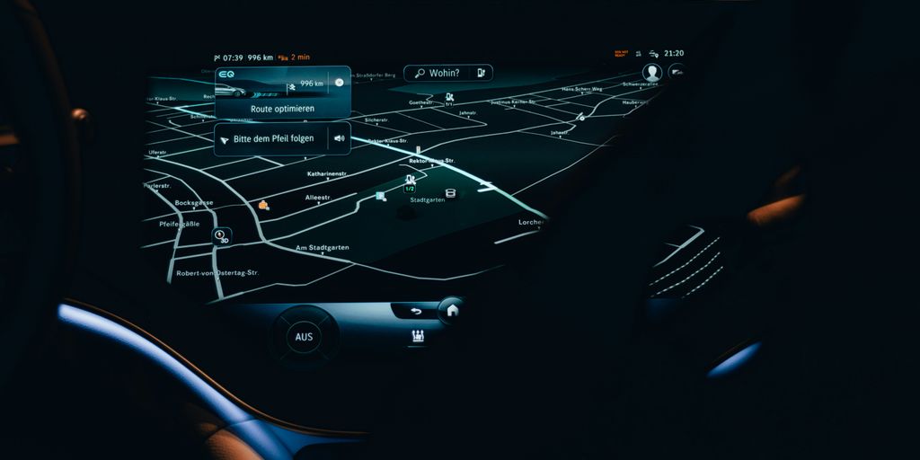
So, you know GPS, right? It’s that thing on your phone that tells you where to go. But what if it suddenly stopped working? It’s not just about getting lost on your way to the grocery store. Our whole world, from planes flying overhead to ships delivering goods, relies on it. Lately, there’s been a lot of talk about finding something else, an alternative to GPS, because depending on just one system can be risky. We’re talking about national security stuff and even how much money we could lose if GPS goes haywire. Plus, there are more and more weird signals messing with GPS, making things a bit shaky. It’s clear we need a backup plan, or maybe even something better.
Key Takeaways
- Our current reliance on GPS has some big problems, like security issues and economic risks, especially with all the signal interference happening.
- Using systems based on signals from the ground, not satellites, could be a good alternative to GPS, especially in cities where satellite signals struggle.
- New tech, like super-fast 5G networks and crazy accurate quantum systems, might give us new ways to figure out where we are without GPS.
- Putting a new navigation system in place across the whole country won’t be easy; there are lots of practical hurdles, rules to change, and money to find.
- If we don’t find a good alternative to GPS, important areas like air travel, shipping, and even our everyday phone apps could face serious trouble.
The Urgent Need for an Alternative to GPS
GPS is great, right? We use it for everything. But what if it suddenly stopped working? That’s the question a lot of people are starting to ask, and the answers aren’t exactly comforting. We’re way too reliant on a single system, and that’s a problem.
Growing National Security Concerns
It’s no secret that GPS signals can be jammed or spoofed. Spoofing is when someone sends out fake GPS signals to trick receivers into thinking they’re somewhere else. This isn’t just a theoretical concern; it’s happening more and more. Imagine the chaos if military operations relied on compromised GPS data. That’s why having backup systems is so important for national security. We can’t afford to have our defense systems vulnerable to GPS interference.
Economic Vulnerabilities of GPS Reliance
Think about all the industries that depend on GPS: shipping, aviation, agriculture, construction… the list goes on. A widespread GPS outage could cripple these sectors, leading to massive economic losses. It’s like having all your eggs in one basket – a very fragile basket. We need to diversify our navigation infrastructure to protect our economy from potential disruptions. Consider the following:
- Supply chain disruptions
- Delays in transportation
- Increased operational costs
Rising GPS Interference and Spoofing
Reports are showing a disturbing increase in GPS interference and spoofing incidents around the world. This isn’t just about getting slightly inaccurate directions on your phone; it’s about potentially catastrophic failures in critical systems. Airplanes veer off-course due to spoofed signals. Ships could run aground. Self-driving cars could go haywire. The risks are real, and they’re growing. We need to take this seriously and develop alternative navigation technologies that are more resistant to interference and spoofing.
Ground-Based Systems as a Viable Alternative to GPS
GPS is great, until it isn’t. Satellite signals can be blocked, jammed, or spoofed. That’s why exploring ground-based systems as alternatives makes a lot of sense. They offer some unique advantages, especially in situations where GPS struggles.
Leveraging Terrestrial Signals for Navigation
Instead of relying on satellites orbiting the Earth, ground-based systems use signals transmitted from towers and other fixed locations. Think of it like a super-charged version of old radio navigation systems, but with way more accuracy. These systems can provide positioning data by measuring the time it takes for signals to travel from multiple transmitters to a receiver. It’s a different approach, and that difference is what makes it valuable.
Enhanced Stability in Urban Environments
One of the biggest problems with GPS in cities is that tall buildings block or reflect satellite signals. This leads to inaccurate positioning or complete signal loss. Ground-based systems, with their transmitters positioned closer to the ground, can often provide more reliable coverage in these challenging urban canyons. It’s all about geometry, really. More ground-level signals mean fewer obstructions.
Overcoming Satellite Signal Obstructions
Beyond urban areas, there are other situations where satellite signals struggle. Think about indoor environments, tunnels, or even dense forests. Ground-based systems can be deployed to fill these gaps in coverage. For example, imagine a warehouse using a PNT system based on local transmitters to track inventory. Or a mine using a similar system to keep tabs on equipment and personnel underground. The possibilities are pretty broad. Here’s a quick comparison:
| Scenario | GPS Performance | Ground-Based System Performance |
|---|---|---|
| Open Sky | Excellent | Good |
| Urban Canyon | Poor | Good |
| Indoors | None | Good |
| Heavy Foliage | Poor | Fair |
| Underground | None | Good |
Advanced Technologies Paving the Way for an Alternative to GPS
GPS is great, but what happens when it’s not available? Or worse, when it’s being messed with? That’s where advanced tech comes in. We’re not just talking about incremental improvements; we’re talking about stuff that could completely change how we think about navigation. It’s a wild time to be alive, honestly.
5G Networks for Precise Location Data
Okay, so you know how 5G is supposed to be super fast for your phone? Well, it can also be super precise for location. 5G networks have the potential to offer location data that rivals, or even exceeds, GPS accuracy in certain environments. Think about it: dense networks of cell towers constantly communicating with devices. That constant communication can be used to pinpoint location with incredible accuracy. It’s not just about finding the nearest coffee shop; it’s about guiding autonomous vehicles, tracking assets in real-time, and enabling all sorts of new applications. The possibilities are pretty mind-blowing.
Quantum Technologies for Unprecedented Accuracy
Quantum stuff is usually reserved for sci-fi movies, but it’s starting to become a reality. Quantum clocks, for example, are so accurate that they lose maybe a second over billions of years. Imagine using that kind of precision for navigation! We’re talking about systems that are virtually immune to jamming and spoofing. It’s still early days, but the potential is there. Advanced Navigation is already exploring technologies like fiber optic gyroscopes to improve accuracy. It’s like going from a map and compass to knowing exactly where you are down to the atomic level.
Exploring Novel Terrestrial Radio Signals
Satellites aren’t the only way to send signals. There’s a whole world of terrestrial radio signals out there, and some researchers are looking at how to use them for navigation. Think about existing radio towers, TV transmitters, and even new, dedicated navigation beacons. The idea is to create a network of ground-based signals that can provide positioning information, especially in areas where GPS is unreliable. It’s like building a backup navigation system using infrastructure that’s already in place. Plus, terrestrial signals are harder to jam than satellite signals, making them a more secure option. Here are some potential benefits:
- Increased resilience in urban canyons
- Reduced dependence on satellite infrastructure
- Enhanced security against jamming and spoofing
Policy and Implementation Challenges for an Alternative to GPS
Logistical Hurdles in National Scale Deployment
Okay, so we’ve got these cool new technologies that could replace GPS. Awesome! But how do we actually, you know, do it? That’s where the fun begins. Think about it: rolling out a completely new navigation system across the entire country? It’s not like swapping out lightbulbs. We’re talking about infrastructure, compatibility, and a whole lot of coordination. The sheer scale of deployment presents a massive logistical challenge. It’s going to take time, resources, and a serious amount of planning. We need to consider things like:
- Building new ground stations or upgrading existing ones.
- Ensuring that all devices (cars, planes, phones) can actually use the new system. That’s a lot of devices!
- Dealing with potential interference or conflicts with existing systems.
It’s a huge undertaking, and honestly, it’s probably going to be a bit messy. But hey, no one said it would be easy. Maybe we can learn from the FCC’s Notice of Inquiry to help guide the way.
Necessary Policy Changes and Regulatory Frameworks
Alright, so we’ve got the tech, we’ve (sort of) figured out the logistics. Now comes the really exciting part: paperwork! Seriously though, new tech means new rules. We need to update our policies and regulations to make sure everything is safe, fair, and secure. Think about things like:
- Who’s in charge of the new system? A government agency? A private company? Some weird hybrid?
- What are the standards for accuracy and reliability? We don’t want planes flying into mountains because of a glitch.
- How do we protect the system from hackers and spoofers? Remember that latest safety report that documented a huge increase in GPS interference? Yeah, we need to avoid that.
It’s a whole new world of regulations, and we need to get it right. Otherwise, we’re just asking for trouble. It’s important to consider the economic vulnerabilities of GPS reliance when creating these new policies.
Securing Funding for New Navigation Technologies
Let’s be real: none of this is going to happen without money. Lots and lots of money. Developing and deploying a new navigation system is expensive. We need to figure out where that money is going to come from. Is it going to be taxpayers? Private investors? A combination of both? And how do we make sure that the money is being spent wisely? We don’t want another government boondoggle on our hands. Some things to consider:
- Lobbying for government funding. This means convincing politicians that this is a worthwhile investment.
- Attracting private investment. This means showing investors that there’s a real return on investment.
- Finding creative funding solutions. Maybe a Kickstarter campaign? (Just kidding… mostly.)
Securing funding is going to be a major hurdle, but it’s a necessary one. Without it, all our fancy new tech will just sit on the shelf, gathering dust. We need to think about the ground-based systems that could be used and how much they will cost to implement.
Impact on Critical Sectors Without an Alternative to GPS
Aviation Safety and Operational Reliance
Aviation is incredibly reliant on GPS. Without a reliable alternative, the potential for disaster increases significantly. Think about it: planes miscalculating their positions due to erroneous signals could lead to accidents. The FAA is working on authentication capabilities to combat spoofing, but that’s just one piece of the puzzle. We need backup systems, and fast. The International Air Transport Association’s (IATA) latest safety report showed a huge increase in GPS interference and spoofing attacks, so this isn’t just a theoretical problem.
Shipping Industry Logistics and Supply Chains
The shipping industry uses GPS for tracking vessels and ensuring safe passage. Disruptions could cause logistical nightmares, impacting supply chains and consumers. Imagine the chaos if ships can’t accurately determine their location! It’s not just about delays; it’s about the potential for accidents and economic losses. We’re talking about a system that underpins global trade, and it’s vulnerable. The FCC is exploring GPS alternatives to address these vulnerabilities.
Consumer Reliance on Smartphone Navigation
We all use navigation apps on our smartphones. From ridesharing to food delivery, a stable positioning system is vital. What happens when GPS goes down? Suddenly, those services become unreliable, and we’re all left scrambling. It’s a convenience, sure, but it’s also become a necessity for many. The rise in GPS spoofing is a real concern, and it’s something that affects everyone, not just big industries. We need to make sure consumer interests are considered as new technologies are developed.
Multi-Constellation Strategies: A Robust Alternative to GPS
GPS is great, but what happens when it’s not available, or worse, being messed with? That’s where multi-constellation strategies come in. Basically, instead of relying solely on GPS, we tap into other global navigation satellite systems (GNSS) like Galileo (Europe), GLONASS (Russia), and BeiDou (China). It’s like having multiple maps instead of just one – if one is wrong, you’ve got others to check against.
Integrating Multiple GNSS Constellations
Think of it as diversifying your investment portfolio, but for navigation. Instead of putting all your eggs in the GPS basket, you spread the risk across multiple systems. This means devices can pull data from various sources, improving accuracy and reliability. Most smartphones already do this, using GPS along with other constellations to pinpoint your location. It’s not just phones, either. Fleet tracking systems, drones, and even augmented reality apps use multiple GNSS for better performance. The land surveying software market is also seeing the benefits of this approach.
Enhancing Resilience Through Signal Diversity
More signals mean more options, and that’s a good thing when it comes to resilience. If one signal is weak, blocked, or being spoofed, the device can switch to another. This is especially important in areas with obstructions like cities or dense forests. Plus, different constellations use different frequencies and orbital patterns, making the overall system more robust against interference. It’s like having backup generators for your navigation system.
Rejecting Spoofed or Erroneous Signals
One of the biggest advantages of multi-constellation systems is the ability to cross-check signals. If one constellation is providing inaccurate data, the device can identify and reject it, relying on the other, more reliable sources. This is crucial for safety-critical applications like aviation and autonomous driving, where a single bad signal could have catastrophic consequences. The FCC is exploring GNSS receivers and mobile networks to improve PNT infrastructure. This ability to reject bad data is a key part of making sure we can trust our navigation systems.
The Role of Inertial Navigation Systems as an Alternative to GPS
Okay, so GPS isn’t the only game in town, right? We’ve all heard about the vulnerabilities and the need for backups. One of the coolest alternatives? Inertial Navigation Systems, or INS. These things are seriously interesting because they don’t rely on external signals at all. Let’s break it down:
Independent Positioning Capabilities
Basically, INS uses accelerometers and gyroscopes to track an object’s movement. These sensors measure acceleration and rotation, and from that data, the system calculates position, orientation, and velocity. It’s like dead reckoning, but way more advanced. Think about it: no satellites needed. No signal jamming worries. It’s all self-contained. The downside? They can drift over time, so accuracy degrades without occasional updates. But still, pretty neat.
Complementing Satellite-Based Systems
Here’s the thing: INS isn’t meant to replace GPS entirely (at least, not yet). It’s more about working together. Imagine a scenario where GPS is unavailable – maybe due to jamming or just a bad signal. That’s where INS kicks in, providing a backup navigation solution. It fills the gaps, ensuring accurate navigation even when GPS fails. Plus, combining the two can actually improve overall accuracy and reliability. It’s like having a safety net for your navigation system.
Applications in High-Precision Environments
INS really shines in situations where pinpoint accuracy is a must. Think about things like:
- Aerospace: Guiding missiles or aircraft where GPS might be unreliable or unavailable.
- Underwater Navigation: Submarines can’t exactly use GPS, so INS is crucial for knowing where they are.
- Robotics: Autonomous robots in warehouses or factories need precise positioning, and INS can help.
Basically, anywhere you need super-accurate, reliable navigation, and GPS isn’t enough, INS is a great option. It’s not perfect, but it’s a solid piece of the puzzle when we’re talking about alternatives to GPS. It’s encouraging that the FCC is considering inertial navigation systems as part of the solution.
Wrapping Things Up: What’s Next for Navigation?
So, as we finish up, it’s pretty clear that while GPS has been a game-changer for a long time, we can’t just rely on it forever. Thinking about other ways to figure out where we are, like using ground signals or even new tech like 5G, is a smart move. It’s not about getting rid of GPS entirely; it’s more about making sure we have backups and better systems in place. This whole process is going to take some work, with lots of different groups needing to talk and plan together. But if we do it right, we can make sure our navigation systems are super strong and ready for anything the future throws at them. It’s a big job, but it’s one we definitely need to tackle.
Frequently Asked Questions
What is GPS and why is it so important?
GPS, or Global Positioning System, is a system that uses satellites to tell us exactly where we are on Earth. It’s super important for things like finding directions on your phone, guiding airplanes, and even helping ships navigate the oceans.
Why is the U.S. government looking for other ways to navigate besides GPS?
The U.S. government is worried because we rely too much on just one system (GPS). If something went wrong with GPS, like if it was attacked or stopped working, it could cause big problems for our country’s safety and economy. They want to find other ways to navigate so we aren’t caught off guard.
What are some of the new technologies being considered as GPS alternatives?
Some of the new ideas include using signals from towers on the ground, like how cell phones work. They’re also looking at super-fast 5G internet networks and even really advanced ‘quantum’ technologies that could be incredibly accurate. The goal is to have many options, not just one.
What are the biggest challenges in making these new navigation systems happen?
It’s tricky because putting new systems everywhere in the country costs a lot of money and takes a lot of planning. Also, new rules and laws might be needed to make sure these new technologies work safely and fairly for everyone.
How would a GPS failure affect everyday life and important industries?
If GPS stopped working, it would be a huge mess! Airplanes might have trouble landing safely, big cargo ships could get lost, and even simple things like ordering food delivery on your phone might not work because the apps rely on GPS to find you.
What does it mean to use ‘multiple satellite systems’ for navigation?
Instead of just using GPS, many systems are already starting to use signals from other satellite systems around the world, like Europe’s Galileo or Russia’s GLONASS. This is like having multiple backup plans, so if one system has problems, others can still help you find your way.