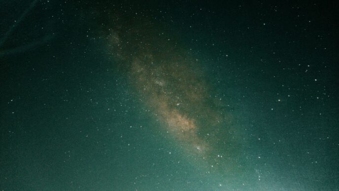
Ever look up at the night sky and wonder what’s up there? It turns out, a lot more than you might think is zipping around above us. We’re talking about satellites, and thankfully, there are some pretty cool tools out there that let you see them in real-time. Whether you’re just curious or want to become a serious sky watcher, these satellite tracker options can really change how you see space. You can track everything from the International Space Station to those Starlink trains. Let’s check out some of the best ways to keep an eye on what’s orbiting.
Key Takeaways
- There are many websites and apps that act as a satellite tracker, showing you where satellites are in real-time.
- These tools can predict when satellites, like the ISS or Starlink, will be visible from your location.
- Some satellite tracker apps use augmented reality (AR) to help you spot satellites directly in the night sky.
- Platforms like NASA Worldview let you see Earth from space, showing real-time weather and imagery.
- Popular satellite tracker options include Heavens-Above, N2YO.com, and Satellite Tracker by Star Walk, each offering different features for sky watchers.
Discover the Best Satellite Tracker Tools
So, you’re looking to keep an eye on what’s zipping around above us? It’s pretty cool to think about all those satellites, from the International Space Station to massive constellations like Starlink, constantly orbiting our planet. Luckily, there are some really neat tools out there that make it easy to see where they are, right now.
Navigating the World of Satellite Tracking Websites
When you first start looking, it can seem like a lot. There are websites that specialize in showing you exactly where a satellite is at any given moment. These sites often have interactive maps where you can see a satellite’s path across the globe. Some are really detailed, showing you things like altitude, speed, and even the satellite’s next pass over your specific location. It’s like having a live radar for space. A great place to start exploring is N2YO.com: Live Real-Time Satellite Tracking, which lets you search for almost any satellite and see its current position.
Understanding Real-Time Satellite Position Trackers
What makes these trackers so useful is their real-time data. They pull information from various sources to give you up-to-the-minute positions. This means you can often see the ISS or a bright Starlink satellite fly overhead with your own eyes, just by knowing when and where to look. Many sites will even let you set up alerts for when a satellite will be visible from your backyard. It turns a distant concept into something you can actually witness.
Exploring Comprehensive Satellite Databases
Beyond just real-time tracking, some tools offer much more. They maintain huge databases of satellites, including active ones, old junk, and even planned launches. You can often filter these databases by type, like weather satellites, communication satellites, or scientific missions. This depth allows you to really explore the space environment. Some sites even provide historical data or information about a satellite’s mission. It’s a fantastic way to learn about the sheer number of objects we’ve put into orbit.
Visualize Earth From Orbit
It’s pretty amazing to think that we can see our planet from the same vantage point as the satellites whizzing around us. Forget just tracking where they are; some tools let you actually see Earth as they see it, right now. It’s like having a live window to the world, but from way up high.
Leveraging Satellite Imagery Platforms for Earth Observation
Lots of satellites aren’t just for communication or navigation; they’re also taking pictures of Earth. These images can show us all sorts of things, from weather patterns to how land is changing. It’s a way to get a global perspective on what’s happening down here.
Exploring NASA Worldview for Real-Time Cloud Cover
NASA’s Worldview is a really neat tool. It pulls together satellite images so you can see what the Earth looks like, often with only a short delay after the satellite takes the picture. You can zoom in on different parts of the world and see things like cloud cover. It’s not super high-res, so you won’t see individual houses, but you can definitely track big weather systems. They have different data layers you can switch between, which is pretty cool for seeing specific information.
Utilizing NOAA’s Weather Satellite Imagery
When you want to know about the weather, NOAA’s satellites are a great source. Tools like Zoom Earth pull data from NOAA’s GOES satellites, among others. These give you a look at cloud movements, storms, and even things like smoke from wildfires. The images update pretty frequently, sometimes every 10 to 15 minutes. This means you can watch weather systems develop and move across the globe in near real-time. It’s a fantastic way to get a visual sense of what’s happening with the weather, from a satellite’s point of view.
Enhance Your Sky-Watching Experience
Looking up at the night sky can be pretty amazing on its own, but knowing what’s actually up there adds a whole new layer. Satellite tracking apps can really change how you see things.
Augmented Reality Features in Satellite Tracking Apps
Some apps have this cool feature called Augmented Reality, or AR. Basically, you hold up your phone, and it uses your camera and sensors to show you where satellites are in the real sky. It’s like a video game, but with actual spacecraft! You can point your phone at a spot, and the app will show you a little icon of the satellite moving across your screen, right where it should be. This makes it way easier to find things like the International Space Station (ISS) or those long strings of Starlink satellites. It’s a big help, especially if you’re new to this or trying to show friends.
Mobile Apps for Identifying Satellites in the Night Sky
There are lots of mobile apps designed just for this. They often have a big list of satellites, and you can pick ones you want to follow. When one of your chosen satellites is about to pass overhead, the app can send you an alert. Some apps even let you see a 3D model of the satellite and its path on a map before it flies by. It’s pretty neat to know exactly when and where to look. You can even set up notifications for specific satellites, so you don’t miss a chance to see them.
The Thrill of Spotting the ISS and Starlink Trains
Seeing the ISS glide across the sky is a really special moment. It’s a bright, fast-moving light that looks like a plane, but it doesn’t blink. Apps that tell you when it’s coming make it possible for almost anyone to catch a glimpse. Then there are the Starlink trains – those lines of lights that appear after a new batch of Starlink satellites is launched. They look pretty unusual and have gotten a lot of attention. Being able to track these events means you can go outside and witness these modern marvels of engineering with your own eyes. It’s a great way to feel connected to what’s happening in space right now.
Key Features of a Powerful Satellite Tracker
So, you’re looking to track satellites, huh? That’s pretty cool. But not all trackers are created equal, and picking the right one can make a big difference in how much fun you have. Let’s break down what to look for.
Choosing Between Map View and Sky View Tracking
Most web-based trackers will show you a map. This is usually a 2D or sometimes a 3D view of the Earth, with lines showing where a satellite is currently flying or will be. It’s good for seeing the big picture, like the ground track of the International Space Station as it circles the globe. Mobile apps, though, often add what’s called a ‘sky view’ or ‘augmented reality’ (AR) mode. This is where the app uses your phone’s camera and compass to show you exactly where to look in the real night sky. It’s like a video game overlay, pointing out satellites as they pass overhead. If you’re new to this, the AR feature is really helpful for actually spotting things.
Database Size and Satellite Focus
Think about what you actually want to track. Some trackers have massive databases, listing thousands of satellites, including the big ones like the ISS, Starlink trains, and even some space junk. Others might focus on just a few popular objects, like the ISS or bright planets. If you’re interested in a specific type of satellite, like a particular weather satellite or a small amateur radio CubeSat, you’ll want to make sure the tracker can find it. A bigger database is great, but sometimes it can be a bit much. Many apps let you create a ‘favorites’ list of the satellites you care about most, which can simplify things.
Offline Use and Data Update Frequency
This is a big one, especially if you plan to do any tracking away from Wi-Fi. Websites, naturally, need an internet connection. But some mobile apps can download their satellite data and work even when you’re offline. This is super handy if you’re out in the middle of nowhere trying to catch a satellite pass. Also, consider how often the data gets updated. Satellites are always being launched or having their orbits changed slightly, so a tracker that updates its information regularly will be more accurate. Some apps update daily, which is usually plenty.
Popular Satellite Tracking Applications
So, you’ve got your eye on the sky and want to know what’s zipping around up there. Luckily, there are some really solid tools out there that make tracking satellites pretty straightforward. We’re talking about websites and apps that can tell you exactly when and where to look.
Heavens-Above: A Long-Running Favorite
Heavens-Above has been around for ages, and for good reason. It’s a go-to for folks who are serious about spotting satellites and other celestial events. You tell it where you are, and it spits out predictions for upcoming passes of everything from the International Space Station (ISS) to Iridium flares. It even shows you a star chart with the satellite’s path, which is pretty neat. It’s free to use on the web, and they have a mobile app too.
N2YO.com: Live Real-Time Satellite Tracking
If you need to know where a specific satellite is right now, N2YO.com is a great choice. It tracks thousands of objects in real-time. You can search for any satellite by name or its catalog number, and then see its current location on a map. It also gives you details like its altitude, speed, and orbital path. The site’s tagline, "Select any satellite orbiting the Earth and check where it is located now," really sums it up. It’s free and doesn’t require a login for basic use, which is handy.
Satellite Tracker by Star Walk for Visual Experiences
For those who appreciate a more visual approach, the Satellite Tracker app by Star Walk is a good pick. It boasts a catalog of over 19,000 satellites. You get real-time positions, and it includes an augmented reality (AR) Sky View mode. This means you can point your phone at the sky, and it’ll show you what satellites are passing overhead, even giving you 3D models. It’s available on most mobile platforms, with some features available through in-app purchases.
Engaging with Space Activities
It’s pretty amazing how these satellite trackers can actually make space feel a lot closer, right? It’s not just about knowing where things are; it’s about connecting with this whole space age thing in a way that feels real. Think about it – you can get an alert on your phone and then step outside to see the International Space Station gliding overhead. That’s a pretty cool moment, and it’s something millions of people have experienced, often thanks to a simple app telling them when to look. It turns something abstract, like ‘satellites are up there,’ into something you can actually witness.
This connection is really powerful for a lot of different people. For amateur astronomers, it’s another target to observe, maybe even photograph. Teachers are using these tools to get students excited about science, letting them track the ISS or look at weather patterns from orbit. And even if you’re just curious, seeing a satellite pass is a neat experience. It’s become a bit of a shared activity, too. When a big event happens, like a Starlink launch creating that ‘train’ effect, people share their sightings online, all thanks to these tracking tools. It’s a way to feel part of something bigger, a shared human endeavor happening right above our heads.
Here’s a quick look at who gets a kick out of this:
- Hobbyists and Stargazers: They use trackers to plan when to see satellites like the ISS or even old favorites like the Hubble Space Telescope. Some even try to photograph them passing in front of the moon!
- Educators and Students: Teachers find these apps great for hands-on learning about orbits, Earth science, and space exploration. It makes STEM topics more tangible.
- Curious Public: Many people just enjoy the thrill of seeing a man-made object fly across the night sky, especially when an app gives them a heads-up.
These tools really do make space accessible. You can follow a new satellite launch or watch a cargo capsule approach the space station in real time. It’s a direct way to engage with what’s happening beyond our atmosphere. For anyone interested in what’s going on up there, checking out a site like N2YO.com for live tracking can be a great starting point.
Keep Looking Up!
So, we’ve looked at a bunch of ways to see what’s flying overhead, from simple websites to apps that use your phone’s camera. It’s pretty amazing that you can track the ISS or even those Starlink trains right from your computer or pocket. These tools make space feel a lot closer, whether you’re just curious or really into astronomy. With so many satellites going up, knowing about them is only going to get more interesting. The International Space Station is still a big deal, and thanks to these trackers, anyone can get excited about seeing it. So go ahead, pick a tool, look up at the sky, and see what you can find. Happy tracking!
Frequently Asked Questions
What exactly is a satellite tracker?
A satellite tracker is like a special map or app that shows you where satellites are in space, right now! It uses information about their paths to display their location on a map or even in your sky using your phone’s camera.
Can I really see satellites from my backyard?
Yes, you can! Many satellites, like the International Space Station (ISS) and Starlink satellites, are bright enough to see with your eyes. Tracker apps can tell you exactly when and where to look for them.
Are these tracking tools difficult to use?
Not at all! Many are designed for everyone, from curious beginners to space fans. They often have simple maps and clear instructions, and some even use your phone’s camera to guide you.
Do I need to pay to track satellites?
Many excellent satellite tracking websites and apps are free to use. Some offer extra features if you pay a small amount, but you can still have a lot of fun tracking satellites without spending any money.
What’s the difference between a website tracker and a mobile app?
Website trackers are great for viewing detailed maps on your computer. Mobile apps are super handy because you can take them outside and use features like ‘sky view’ or augmented reality (AR) to see satellites directly in your night sky.
Besides tracking, what else can these tools do?
Many tools also show you cool pictures of Earth taken from space, like weather patterns or cloud cover. Some can even alert you when a satellite is about to pass overhead, so you don’t miss seeing it!


