Revolutionizing Wildfire Detection With Satellite Technology
Wildfires are getting worse, and frankly, it feels like we’re always playing catch-up. But now, there’s some really cool tech coming out of space that’s changing the game. We’re talking about satellites that can spot fires way faster and more accurately than before. It’s like having a constant, watchful eye in the sky, which is pretty amazing when you think about how big and fast these fires can move.
AI-Powered Thermal Infrared Constellations
So, how does this work? Imagine a bunch of satellites, all equipped with special cameras that can see heat. These aren’t your average cameras; they use thermal infrared technology. Think of it like a super-powered heat-seeking missile, but for spotting fires. These satellites are constantly scanning the Earth’s surface, looking for hot spots. What’s really neat is that they’re using artificial intelligence, or AI, to sort through all the data. This AI can tell the difference between a real fire and something that just looks like one, like a hot rock or a factory. It’s all about making sure the alerts are actually useful and not just a bunch of false alarms. This system can pick up on heat signatures as small as a few feet across, which is pretty impressive.
24/7 Global Scanning Capabilities
One of the biggest advantages here is that these satellites don’t sleep. They’re up there, orbiting the planet all the time, day and night, rain or shine. This means they can detect a fire the moment it starts, no matter where it is in the world. Before, we relied a lot on people spotting fires or ground sensors, but that’s just not enough for the scale of fires we’re seeing now. Having this constant, global view means we can get information out to firefighters and emergency responders much quicker. It’s like having a global neighborhood watch, but for wildfires. This continuous monitoring is a big step up from older methods that might miss fires in remote areas or during bad weather.
Detecting Fires From Orbit
Basically, these satellites are like the ultimate early warning system. They can see the heat from a fire even through smoke and clouds sometimes, which is a huge deal. They can tell us not just that there’s a fire, but also how big it is and how hot it’s burning. This information is super important for figuring out how to fight the fire effectively. It helps fire managers understand the situation on the ground much better, allowing them to send the right resources to the right places. It’s a whole new way of looking at wildfires, giving us a bird’s-eye view that’s incredibly detailed and timely.
Advancements in Fire Intelligence and Forecasting
It’s not just about spotting a fire anymore; we’re getting much smarter about predicting where they might pop up and how they’ll behave. Satellites are playing a bigger role in this, moving from just watching to actively helping us get ahead of the curve. This shift is all about using the data we collect to build better forecasts and give fire managers more useful information.
Predictive Fire Intelligence Systems
Think of this as looking into the future of fires. We’re using satellite data, combined with weather patterns and information about the land itself, to guess where fires are likely to start and how quickly they might spread. This isn’t just a guess, though. These systems look at things like how dry the vegetation is, the type of plants in an area, and the local weather. By combining all this, we can get a heads-up days or even weeks in advance about high-risk areas. This helps agencies prepare resources and plan their strategies before a fire even starts.
Integrating AI for Fire Spread Modeling
Artificial intelligence is a game-changer here. We’re training AI models on years of satellite images and fire data. These models can spot patterns that humans might miss, like how certain weather conditions combined with specific types of dry brush tend to lead to fast-spreading fires. They can then simulate how a fire might move across the landscape, taking into account wind, terrain, and fuel types. This gives us a much clearer picture of potential fire behavior, helping us understand not just where a fire is, but where it’s headed.
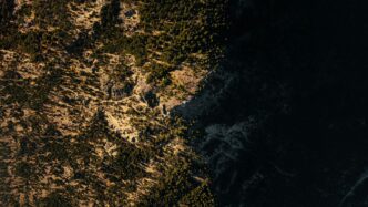
Thermal Sensing for Ignition Signatures
Fires give off a specific kind of heat, especially when they’re just starting. Satellites equipped with special thermal sensors can pick up on these heat signatures, even small ones, against the cooler background of the land. This is like an early warning system. By looking at the specific heat patterns, we can often tell if it’s a real fire or something else. This technology is key to detecting fires very early, sometimes even before they become large and visible from the ground or from less specialized satellites.
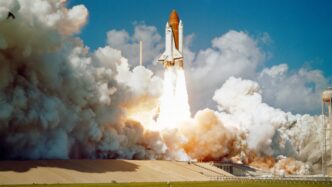
New Satellite Constellations for Enhanced Monitoring
It feels like every year, wildfires are getting worse, and honestly, it’s pretty scary. We’re seeing more of them, and they’re burning hotter and faster. That’s why the new satellite setups being launched are such a big deal. They’re not just general Earth-watching satellites anymore; these are purpose-built for spotting fires.
Purpose-Built Fire Observation Satellites
Think of it like this: instead of using a camera that takes regular pictures, these new satellites are equipped with specialized sensors. For instance, the FireSat constellation, a project involving Google Research and the Earth Fire Alliance, is designed from the ground up for fire detection. It uses six-band thermal sensors, which are way better at picking up heat signatures than regular cameras. They’re even putting AI right on the satellite to process the information quickly. This means alerts can be sent out within minutes of a fire starting, which is a massive improvement. OroraTech is also launching its own constellation, focusing on thermal satellites that can detect heat anomalies as small as 10 to 15 feet across. They’re aiming for a network that can scan the entire planet, day and night, all year round. It’s all about getting eyes in the sky that are specifically trained to see fire.
High-Resolution Thermal Sensors
What’s really changing the game is the detail these new sensors can capture. Older systems might miss smaller fires or fires hidden under thick tree canopies. But these new constellations are packing high-resolution thermal sensors. FireSat, for example, can detect fires as small as 5×5 meters. OroraTech’s satellites are even aiming for 4×4 meter resolution. This level of detail is important because it allows for much earlier detection. Spotting a fire when it’s just a few meters wide gives firefighters a much better chance to get it under control before it grows into a monster. These sensors can also measure the intensity of a fire, giving us a better idea of how dangerous it is and how fast it might spread. It’s like going from a blurry black-and-white photo to a sharp, detailed color image – you can see so much more.
Global Coverage and Rapid Alerts
One of the biggest challenges with wildfire response is knowing where the fires are, especially in remote areas. These new satellite constellations are designed to provide global coverage, meaning they’re not just watching one region. FireSat plans to scan the entire globe every 20 minutes. This constant monitoring is key. When a fire starts, every minute counts. Having satellites that can provide rapid alerts means that emergency managers and firefighters get the information they need much faster. This allows them to make quicker decisions about evacuations, resource deployment, and suppression strategies. It’s about building a global network that acts like an early warning system, giving people precious time to react. This kind of real-time data is what’s needed to improve how we manage wildfires, and it’s exciting to see these systems coming online. It’s a big step towards making our communities safer, much like how wearable devices help monitor personal health.
Addressing Challenges in Satellite Fire Detection
While the advancements in satellite technology for wildfire detection are truly impressive, it’s not all smooth sailing. We’re still wrestling with a few key issues that can make getting a clear picture of a fire a bit tricky.
Minimizing False Positives
One of the biggest headaches is cutting down on false alarms. Imagine getting an alert about a wildfire, scrambling resources, only to find out it was just a hot factory roof or a particularly sunny patch of desert. It happens. Algorithms are getting smarter, using machine learning to cross-reference data from different sources. They can filter out obvious non-fires, like detecting a blaze during a downpour. But still, especially in areas with lots of industrial heat or even volcanic activity, distinguishing a real fire from background heat can be tough. Some systems still report a significant number of false alarms, depending on the terrain and what’s going on at ground level.
Overcoming Cloud Cover and Canopy Interference
Clouds are the enemy of many satellite observations, and wildfires are no exception. Thick cloud cover, especially in humid or smoky areas, can obscure the ground in a huge percentage of satellite passes. That means a fire could be burning away, and our eyes in the sky just can’t see it. Similarly, dense forest canopies can hide smaller, low-intensity fires burning on the ground. It’s like trying to see a campfire through a thick forest – you might miss it until it gets much bigger.
The Accuracy Paradox in Fire Modeling
Here’s a bit of a head-scratcher: the models we use to predict fire behavior are often trained on historical data. This works pretty well when fires behave in ways we’ve seen before. But what happens when we get extreme weather events, like record-breaking heatwaves, or when climate change starts shifting vegetation patterns? The models can struggle. They might be great at predicting a typical fire season, but they can falter when conditions are truly unusual. This is a problem because, well, those unusual conditions are becoming more common. We need models that can adapt and predict accurately even when things go off the usual script.
Satellite Data Supporting Climate Science and Mitigation
It’s not just about putting out fires right now, though. Satellites are also giving us a much clearer picture of how our planet is changing, and how fires fit into that bigger puzzle. Think of it as a way to track climate trends from space. For example, researchers are using this data to get real-time insights into how fires behave and what that means for the climate. This new level of detail is a game-changer for understanding our environment.
Monitoring Climate Trends From Space
These advanced satellite systems are really helping climate scientists track what’s happening with our planet. They can see how fires are affecting things over time, which is pretty important when we’re talking about climate change. It’s like having a constant global check-up.
Insights into Fire Intensity and Emissions
We’re getting better data on how intense fires are, and that tells us a lot. More intense fires mean more carbon is released into the air. This information is key for figuring out the real impact fires have on ecosystems and the atmosphere. It also helps us understand the contribution of smaller, less-obvious fires to overall global emissions, like those tricky overwintering fires in cold places or peat fires in the tropics. We’re starting to get a much clearer picture of the whole fire picture.
Informing Proactive Fire Management Strategies
Beyond just watching fires burn, this satellite data helps agencies be smarter about how they manage forests and prevent fires in the first place. They can use the information to decide where to thin out trees, where to do controlled burns, or where people should focus on making homes safer from fire. It’s about making better choices for where to build, how to treat forests, and when to let nature take its course versus when to step in. This kind of information is also useful for validating forest conservation projects, like those used for carbon credits, by showing that no recent wildfires have occurred in those areas. It’s a big step towards being more proactive instead of just reactive. For instance, new fire shelter technology, inspired by spacecraft heat shields, is being developed to offer better protection for firefighters, showing how innovation extends to all aspects of fire response [c78c].
The Future of Satellites News in Wildfire Response
Wildfires are getting worse, and we’re all feeling it. It’s not just about putting out fires anymore; it’s about being smarter and faster. Satellites are becoming a huge part of that, giving us eyes in the sky that can see things we just can’t from the ground. Think of it as a constant, global watch.
The real game-changer is how this technology is evolving to give us information when it actually matters. We’re moving from just reacting to fires to actually predicting and preventing them. It’s a big shift, and satellites are leading the way.
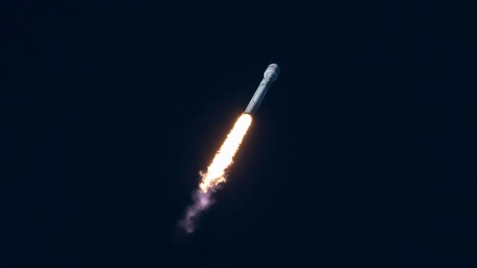
Expanding Satellite Infrastructure
We’re seeing a big push to get more satellites up there, specifically designed for spotting fires. Companies are launching more and more of these, with plans to have hundreds in orbit soon. This means they can check on the same areas much more often, sometimes every half hour.
- More Satellites, More Data: The sheer number of satellites is increasing, providing a more complete picture.
- Faster Passes: Satellites will revisit areas more frequently, cutting down the time it takes to detect a new fire.
- Better Sensors: New satellites are equipped with advanced thermal sensors that can pick up even small heat signatures from space.
Real-Time Data for Fire Managers
Imagine being a firefighter or a land manager. Right now, getting good, up-to-the-minute information can be tough. Satellites are changing that. They can tell us where a fire is, how hot it is, and even where it’s likely to go next. This kind of data helps fire crews make better decisions, faster. It means they can send resources where they’re needed most, potentially saving homes and lives.
Partnerships for Effective Wildfire Solutions
No single company or agency can solve the wildfire problem alone. That’s where partnerships come in. We’re seeing collaborations between satellite companies, government agencies, and research groups. This teamwork is key to making sure the data collected by satellites actually gets to the people who need it and is used effectively.
- Data Sharing: Making sure information flows freely between different groups.
- Integrated Systems: Combining satellite data with on-the-ground reports and other intelligence sources.
- Open Access: Some of this data is being made available to everyone, which helps smaller organizations and researchers who might not have their own satellite capabilities.
The Road Ahead
So, it’s pretty clear that satellites are becoming a really big deal for tracking wildfires. We’re seeing more and more of these specialized satellites being launched, and they’re getting smarter with AI. This means we can spot fires earlier, understand how they might spread, and even help with things like carbon credit projects. While there are still challenges, like clouds blocking the view sometimes, the technology is improving fast. It’s not just about putting out fires anymore; it’s about using this data to make better decisions overall, from where we build our homes to how we manage forests. This is a big step forward in how we deal with wildfires, and it’s exciting to see what comes next.