
Understanding Satellite Fundamentals

So, you want to know what makes a satellite tick? It’s not just a shiny object floating up there; it’s a complex machine with several key parts working together. Think of it like a really high-tech car, but instead of roads, it’s dealing with the vacuum of space and extreme temperatures.
Key Satellite Subsystems Explained
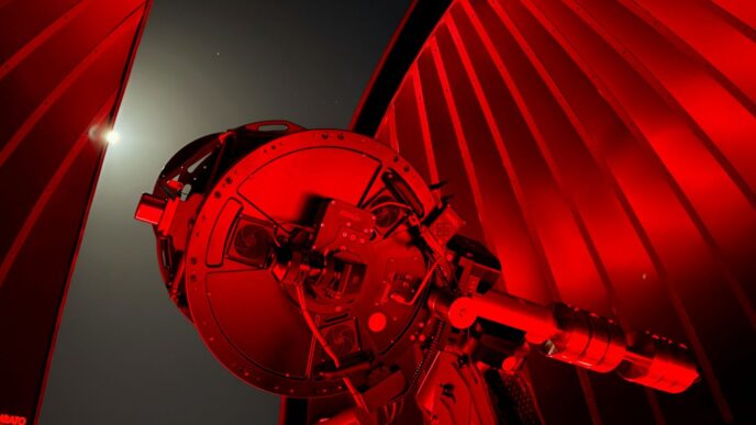
Every satellite is built with a few main systems, and they all have to play nice for the mission to work. You’ve got the power system, which is basically the satellite’s lifeblood, usually coming from solar panels and stored in batteries. Then there’s the communication system, how it talks to us back on Earth. The propulsion system is for moving around and keeping it in the right spot. The thermal control system keeps things from getting too hot or too cold, which is a big deal in space. And don’t forget the data handling system, which is like the satellite’s brain, processing all the information it gathers. Finally, the structural subsystem is the skeleton, holding everything together and making sure it can survive the rough ride of launch and the space environment.
The Role of the Payload Subsystem
Now, the payload is where the real action happens, depending on what the satellite is actually for. If it’s a weather satellite, the payload might be advanced cameras and sensors to watch clouds and storms. For a communication satellite, the payload is the equipment that receives, processes, and sends signals back down. It’s the part that does the main job, the reason the satellite is even up there. The design of this subsystem is super specific to the mission’s goals, whether that’s taking pictures of distant galaxies or beaming internet signals to your house.
Structural Integrity and Reliability
Building a satellite means thinking about how it’s going to hold up. The structural subsystem is the backbone, and it needs to be strong enough to handle the intense shaking and G-forces during launch. Once in space, it has to deal with temperature swings and the general harshness of the environment. To make sure the satellite doesn’t just break down, engineers build in redundancy. This means having backup systems for critical parts. If one component fails, another one can take over. It’s all about making the satellite as reliable as possible, because sending a repair crew isn’t exactly an option.
Satellite Communication Essentials
When we talk about satellites, a big part of what they do is communicate. It’s how they send information back to us here on Earth, and how we send commands up to them. This whole process relies on a few key pieces working together.
Communication Subsystem Components
The communication subsystem is basically the satellite’s "phone system." It’s made up of several parts. You’ve got antennas, which are like the satellite’s ears and mouth, picking up signals and sending them out. Then there are transponders, which are like little signal repeaters – they receive a signal, boost it, and send it back down on a different frequency. Modems are also involved, converting signals so they can be understood by different systems. Without these components, a satellite would be pretty isolated, unable to share its data or receive instructions.
Understanding Transponder Functions
Transponders are really the heart of satellite communication. Think of them as a relay station in space. They receive signals from an Earth station on one frequency (the uplink) and then transmit those same signals back down to another Earth station on a different frequency (the downlink). There are two main types: transparent transponders, which just amplify and retransmit, and processing transponders, which do a bit more work, like demodulating and re-modulating the signal. This frequency shift is important to avoid interference between the signals going up and coming down.
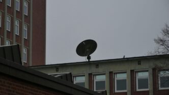
Satellite Antenna Types and Polarization
Antennas are how satellites talk. The most common type you’ll see is the parabolic antenna, which looks like a dish. These are good at focusing signals in a specific direction. Another type is an array antenna, which uses multiple smaller elements to create a beam. Beyond the shape, polarization is also a big deal. You have linear polarization, which can be either vertical or horizontal, and circular polarization, which can be either right-hand or left-hand. Using different polarizations can help prevent interference between signals that are using the same frequencies, almost like having separate lanes on a highway for different types of traffic.
Satellite Orbit and Classification
Satellites don’t just float around randomly; they follow specific paths around Earth, called orbits. Where a satellite is placed and how it’s used helps us categorize it. Think of it like different types of vehicles for different jobs.
Classifying Satellites by Function
Satellites are built for all sorts of tasks. Some are purely for science, like telescopes looking at distant stars or probes studying planets. Others are designed for technology tests, seeing if new equipment works in space. Then you have satellites that help us with everyday life. Communication satellites, for instance, are what we use for TV, phone calls, and internet. Remote sensing satellites are like Earth’s eyes, watching weather patterns or tracking resources. Navigation satellites, like GPS, are pretty obvious – they help us know where we are.
Orbital Heights and Satellite Categories
The height of a satellite’s orbit is a big deal. It affects how much of the Earth it can see and how much delay there is in communication. Here’s a breakdown:
- Low Earth Orbit (LEO): These are the closest to Earth, typically between 200 and 2,000 kilometers up. They move fast and cover small areas, so you need a lot of them for continuous service, like for internet constellations.
- Medium Earth Orbit (MEO): Sitting between 2,000 and 35,786 kilometers, MEO satellites are used for things like navigation systems (GPS, GLONASS, Galileo). They offer a good balance between coverage and signal delay.
- Geostationary Orbit (GEO): At exactly 35,786 kilometers, GEO satellites appear to stay in one spot over the equator. This is perfect for broadcasting and continuous communication because ground antennas don’t need to track them.
- Highly Elliptical Orbit (HEO): These orbits are stretched out, not circular. They spend a lot of time over certain parts of the Earth, making them useful for specific coverage needs, like in polar regions.
Satellite Services Overview
Satellites offer a wide range of services. We’ve got fixed-satellite service for things like VSATs and broadcasting. Then there’s mobile-satellite service, which keeps ships, planes, and even people in remote areas connected. Broadcasting-satellite service is what brings TV channels directly to our dishes. Radiodetermination and radionavigation services use satellites to figure out location. Even amateur radio operators have their own satellites! It’s a diverse ecosystem, all working from space.
Satellite Monitoring Operations
Keeping an eye on satellites is a big job, and it involves a few key steps to make sure everything is running smoothly and that no one is causing trouble. It’s all about listening in, figuring out what you’re hearing, and knowing where it’s coming from.
Signal Reception and Measurement
First off, you need to actually pick up the signals. This means having the right antennas, whether you’re tracking a geostationary satellite way up high or a constellation of satellites zipping around closer to Earth. Once you’ve got the signal, you need to measure it. Think of it like taking a snapshot of the signal’s characteristics. This involves using specialized receivers that can capture data in real-time or process it later. You’re looking at things like the signal’s center frequency, its bandwidth, and its power. It’s also important to note the signal’s polarization and track its position in the sky.
Signal Identification and Surveillance
After you’ve received and measured a signal, the next step is to figure out what it is. Is it a legitimate transmission from a known satellite, or is something unusual happening? This involves analyzing the signal’s parameters, like its modulation type, coding, and the communication protocols it’s using. You might even decode broadcast or TV programs to get more information. Surveillance is about keeping watch for anything out of the ordinary. This could be a sudden change in the signal’s noise level or a transmission that doesn’t match expected patterns. Setting up alarms for these anomalies is a good way to stay on top of things.
Geolocation and Ground Confirmation
This is where things get really interesting, especially when dealing with interference. Geolocation is the process of figuring out where a signal is originating from on the ground. It’s like triangulating a position, but using satellite signals. Techniques like Time Difference of Arrival (TDOA) and Frequency Difference of Arrival (FDOA) are used, often involving signals from multiple satellites to pinpoint a location. Once you have an estimated area, ground teams might be sent out to confirm the source of the transmission. This involves terrestrial measurements and can help identify the specific equipment and even the operator responsible for the signal. It’s a bit like detective work, but with radio waves.
Evaluating Satellite Resource Utilization
So, how do we actually figure out if satellites are being used efficiently? It’s not just about launching them and hoping for the best. We need to look at how they’re performing and what resources they’re actually using. This involves a few key areas, especially when we talk about satellites in geostationary orbit (GSO) versus those that aren’t.
Measuring GSO Satellite Performance
For satellites parked in a geostationary orbit, which means they stay above the same spot on Earth, we’re looking at things like how much of the sky they’re covering and how they’re using the radio frequencies. It’s about making sure their assigned orbital slots aren’t getting too crowded and that their signals aren’t overlapping in ways they shouldn’t. We measure their orbit position occupancy and how much of the available frequency spectrum they’re using. We also check if their power levels, specifically the Power Flux Density (PFD), are within the limits set by international agreements. It’s a way to keep the skies orderly and prevent interference before it even starts. Think of it like managing parking spaces in a busy city; you want to make sure each car has its designated spot and isn’t blocking others. Keeping track of these details helps maintain the health of the satellite network.
Assessing Non-GSO Satellite Monitoring
Satellites that aren’t in a geostationary orbit, like those in low Earth orbit (LEO) or medium Earth orbit (MEO), present a different challenge. Because they’re constantly moving relative to the ground, we need to track them actively. This means we’re not just looking at a fixed orbital position but rather the dynamic path they take. We measure their radio frequency (RF) signals, including things like carrier PFD curves, and check their spectrum occupancy. It’s a bit like tracking a fleet of fast-moving vehicles; you need real-time data to know where they are and how they’re operating. This kind of monitoring helps ensure that these constellations, often made up of many satellites, are working together without causing issues for each other or for ground-based systems. Keeping tabs on these moving assets is key to their effective use.
Spectrum Occupancy and Emission Analysis
This is where we get down to the nitty-gritty of how radio frequencies are being used. Spectrum occupancy is basically a measure of how much of the available frequency band a satellite or a ground station is using at any given time. We analyze emissions to identify what signals are present, where they’re coming from, and if they’re authorized. This includes looking for unauthorized or improper emissions, which could be a sign of interference or misuse. By analyzing the characteristics of these emissions, like their center frequency, bandwidth, and power, we can get a clear picture of the radio environment. It’s important to understand these details to manage the limited radio spectrum effectively and to maintain the integrity of satellite communications. This analysis helps prevent signal collisions and ensures that everyone using the spectrum is doing so responsibly.
Resolving Satellite Interference
When signals from different sources start messing with each other in the satellite world, it’s a real headache. This section is all about figuring out who’s causing the trouble and how to sort it out. It’s not always straightforward, but there are methods to track down the source of the problem.
Identifying Unauthorized Transmitters
Sometimes, signals pop up that aren’t supposed to be there, or they’re just not following the rules. Finding these unauthorized transmitters is the first step. We can use a few different approaches for this:
- Amplitude Comparison: This is a pretty standard way to look at signals. You compare the strength of signals you expect to see with any unexpected ones. If something is way stronger than it should be, it might be an issue.
- Cross-Correlation Algorithm: This is a bit more advanced. It involves comparing signal patterns to find matches, which can help pick out faint interfering signals that might otherwise be missed. It’s like looking for a specific tune in a noisy room.
- Aerial Monitoring: This involves using specialized equipment, often mounted on vehicles or aircraft, to get a better sense of where signals are coming from. It’s a good way to quickly scan an area for rogue transmissions.
Interference Detection and Resolution Techniques
Once you’ve got an idea of who might be causing interference, you need to confirm it and then fix it. This involves a few key steps:
- Signal Measurement: You’ll need to measure various aspects of the interfering signal, like its frequency, bandwidth, and power. This data is like a fingerprint for the signal.
- Geolocation: Pinpointing the exact location of the interfering transmitter on the ground is often necessary. This can be done using techniques that rely on the time it takes for signals to arrive at different receivers.
- Resolution: After identifying and locating the source, the next step is to get it to stop interfering. This might involve working with the operator of the transmitter or, in some cases, regulatory action.
Geolocation Principles for Interference Sources
Figuring out where an interfering signal is coming from is a big part of solving the problem. Here’s how it generally works:
- Using Two Satellites: By measuring the time difference of arrival (TDOA) of a signal at two different satellites, you can narrow down the possible locations of the transmitter to a specific curve. If you use two satellites and measure TDOA, you can get a more precise location.
- Using Three Satellites: Adding a third satellite and its signal arrival times can help pinpoint the location even further. This is often done using TDOA measurements between pairs of satellites.
- Single Satellite Methods: In some cases, a single satellite can be used, especially if the transmitter’s signal has a Doppler shift that can be measured. This shift changes based on the relative movement between the satellite and the transmitter, giving clues to the location.
The goal is to get a location accurate enough to take action.
Key Definitions in Satellite Communications
When we talk about satellites, a few terms pop up a lot. Understanding these can really help clear things up. Let’s break down some of the most common ones you’ll hear.
Effective Isotropic Radiated Power (EIRP)
Think of EIRP as the "strength" of a signal coming from a satellite’s antenna, but measured in a way that’s fair to all antennas. It’s not just about how much power the satellite itself is using; it also accounts for how well the antenna focuses that power in a specific direction. It’s basically the power that an imaginary, perfect "isotropic" antenna would need to radiate to achieve the same signal strength in that direction. We usually measure EIRP in dBW (decibels relative to one watt).
Power Flux Density (PFD) Calculations
PFD tells us how much signal power is spread out over a certain area when it reaches the Earth. This is super important because regulations often limit how strong a signal can be on the ground to avoid interfering with other services or causing issues. It takes into account the EIRP of the satellite, the distance the signal travels, and how the signal spreads out. The formula can look a bit intimidating, but it boils down to how concentrated the power is per square meter at the receiving point.
Here’s a simplified look at what goes into it:
- EIRP: The power being sent out by the satellite.
- Path Loss: How much the signal weakens as it travels through space.
- Antenna Gain: How well the receiving antenna focuses the signal.
- Frequency: Higher frequencies can sometimes be more susceptible to certain types of loss.
Space Radiocommunication and Link Definitions
These terms help us talk about the actual connections. "Space radiocommunication" is a broad term for any radio communication that involves using something in space, like a satellite. A "satellite link," on the other hand, is more specific. It refers to the radio path between a ground station sending a signal and another ground station receiving it, with a satellite acting as the middleman. This involves an "uplink" (ground to satellite) and a "downlink" (satellite to ground), each with its own set of characteristics and potential challenges.
Wrapping Up Our Satellite Chat
So, we’ve covered a lot of ground today, from the basic parts that make a satellite tick, like its power and communication systems, to how we keep track of them and make sure everything is running smoothly. It’s pretty amazing how these complex machines work way up there, sending signals across vast distances. Understanding these different pieces helps us appreciate the whole picture of satellite technology and its role in our connected world. Hopefully, this gave you a good starting point for understanding what goes into making satellites work and why they’re so important.