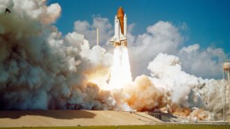

Ever looked up at the sky and wondered what’s happening up there, or how our planet looks from space right now? It’s pretty amazing what technology can do these days. We can actually see live views of Earth from satellites orbiting above us. This guide is all about exploring that world, using tools that let you see our planet in real-time and track satellites as they fly by. Whether you’re just curious or need this data for work, there’s a lot to discover.
Key Takeaways
- You can explore Earth with live satellite tracking, getting real-time views from space.
- Tools like NASA Worldview and USGS EarthNow offer different ways to see live satellite data.
- The International Space Station (ISS) provides a unique live video feed of Earth.
- Satellite tracker live tools help you follow satellites, predict their paths, and visualize their orbits.
- Satellite data has many uses, from farming and environmental monitoring to city planning.
Explore Earth With Live Satellite Tracking
It’s pretty amazing to think about, but we can actually see our planet from space, right now, as it happens. Gone are the days when we only had old photos; now, we have live feeds and constantly updating maps that show Earth as it is this very minute. It’s like having a window to the world, but from way up high.
Understanding Live Satellite Maps
So, what exactly are these live satellite maps? Think of them as constantly refreshed pictures of Earth taken from orbit. They’re not just static images; they’re dynamic views that change as the satellites move and capture new data. This means you can see things like cloud cover moving across continents or even track weather systems as they develop. It’s a way to get a real-time sense of what’s happening on the ground, all displayed on a map.
Real-Time Earth Views from Space
When we talk about real-time views, we’re talking about imagery that’s as current as possible. Services like NASA’s Worldview provide access to data that’s often only minutes or a couple of hours old. This is different from historical satellite photos; this is what’s happening now. You can zoom in on specific regions, watch the progression of daylight across different time zones, and get a feel for the sheer scale of our planet. It’s a fascinating way to connect with the Earth’s dynamic nature.
The Evolution of Satellite Imagery
Satellite technology has come a long way. From the early days of capturing iconic images like the ‘Blue Marble’, we’ve moved to systems that can provide daily, high-resolution views of almost the entire planet. Companies are now using constellations of small satellites to get incredibly detailed pictures every single day. This constant stream of data has changed how we see and interact with our world, making information about our planet more accessible than ever before. You can even track some of the most famous satellites orbiting Earth and see their paths.
Discover Live Satellite Feeds and Views
So, you want to see what’s happening on Earth right now, from way up high? It’s pretty cool stuff. There are a few ways to get these live views, and they all offer something a little different.
First up, there’s NASA Worldview. This is a really neat online tool that gives you a look at satellite imagery and cloud cover. It pulls data that’s usually only a couple of hours old, which is pretty close to live. You can zoom all over the place, but don’t expect to see individual cars or anything; the detail is more like seeing a whole city block at once. Still, it’s a great way to get a general feel for what’s going on globally.
Then you have the USGS EarthNow platform. They use data from Landsat satellites. The cool thing here is how fast the images show up after the satellite beams them down – sometimes it’s just seconds. You can even choose to see images in what they call ‘true color,’ which is basically how our eyes would see it, or pick special views that highlight things like vegetation. It kind of scans the Earth like a live video feed, which is pretty neat.
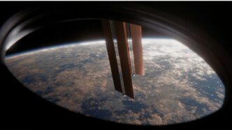
And if you want a truly unique perspective, you can check out the live feed from the International Space Station (ISS). While it doesn’t give you a map or anything like that, it shows you Earth as the astronauts see it, floating about 250 miles up. It’s a really direct, real-time look at our planet from a human viewpoint. It’s one of those things you just have to see for yourself. You can find these kinds of feeds and explore other resources for satellite imagery on various platforms.
Leveraging Satellite Tracker Live for Insights
So, you’ve got this amazing tool that lets you see Earth from space, but what can you actually do with it? Turns out, quite a lot. It’s not just about pretty pictures; it’s about understanding what’s happening down here.
Tracking Satellites in Real-Time
Ever wonder where that satellite is right now? This feature lets you do just that. You can pick a specific satellite, maybe the ISS or a weather satellite, and watch its path across the globe. It’s pretty neat to see these man-made objects zipping around our planet. You can even get a list of upcoming passes over your specific location, so you know when to look up.
Predicting Satellite Flybys
This is where it gets really interesting for skywatchers. The tracker can tell you exactly when a satellite will be visible from your backyard. It gives you a countdown timer and a list of upcoming passes. You can even set alerts so you don’t miss a good viewing opportunity. Imagine knowing precisely when the ISS will streak across the night sky – it makes stargazing a whole new ballgame.
Visualizing Satellite Orbits
Beyond just tracking, you can see the actual paths satellites take around the Earth. It’s like having a 3D model of Earth with all these orbital paths laid out. This helps you grasp the scale of satellite networks and how they cover the planet. You can switch between different views, like a globe view showing the trajectory or a sky view to help you spot them directly.
Advanced Features for Satellite Data Analysis
So, you’ve been playing around with live satellite feeds, which is pretty cool. But what if you want to dig a bit deeper? There are some really neat tools that let you do more than just look. These features turn raw satellite data into actual insights.
Satellite Time Series Analysis
This is where you can really see how things change over time. Think about tracking how a forest grows or shrinks, or how a city expands. You can pick different ‘indices’ – basically, ways of measuring things like vegetation health or water content – and watch how they shift season by season, or even year by year. It’s like having a historical record of the planet, but in a visual format. This helps you spot patterns that aren’t obvious when you just look at a single image.
Data Clustering for Pattern Recognition
Imagine you have a huge pile of satellite pictures of farmland. How do you quickly figure out which fields are doing well and which ones are struggling? Data clustering does this automatically. It groups areas that look similar based on their ‘spectral signatures’ – which is just a fancy way of saying how they reflect light. So, if a bunch of fields have the same healthy green color in the images, they’ll get grouped together. This makes it way easier to see widespread issues or successes without manually checking every single spot.
3D Modeling with Satellite Imagery
This one’s pretty mind-blowing. You can take satellite images, both current and from the past, and turn them into 3D models. This is super useful for understanding terrain. If you’re planning to build something, you can see how it would fit into the landscape. It’s also great for seeing the real-time impact of things like landslides or floods, giving you a better sense of the scale of the event.
Industry Applications of Satellite Tracker Live
It’s pretty amazing how much we can learn about our planet just by looking at it from space, right? Satellite tracking tools aren’t just for space geeks; they’re actually super useful for all sorts of jobs and industries. Think about it – having a bird’s-eye view, updated constantly, can really change how people do their work.
Agriculture and Land Management
Farmers, for instance, can really benefit. Using live satellite images, they can check on their crops’ health, manage grazing land, and keep an eye on how the land itself is changing. This helps them make better decisions day-to-day. Looking at past images over seasons helps them plan where to rotate pastures or which fields might need more attention, like reseeding or extra water. It’s also good for seeing long-term stuff, like soil getting worse or problems with pests that keep coming back.
- Monitor crop health and stress levels.
- Optimize irrigation and fertilization.
- Track land use changes and soil conditions.
Environmental and Climate Change Monitoring
Environmental scientists and conservationists use this tech too. They can watch forests, rivers, and coastlines. When bad stuff happens, like wildfires or floods, these real-time views help people respond faster. Over time, the images show bigger climate patterns, like deserts growing or sea levels going up. It’s a way to see how our planet is changing and to try and protect natural places.
Construction and Urban Planning
City planners and builders use these tools to make smarter choices. They can look at the land and what’s already around it to pick the best spots for building, avoiding risks like erosion or floods. The current images help them check if projects are on schedule and if they’re affecting the environment too much. After a storm, they can quickly see which roads or buildings need fixing first. It’s like having a live map for managing development and making sure things are built safely and efficiently. You can even find great driving roads with apps like Greatest Drive.
- Assess terrain and identify optimal building sites.
- Monitor construction progress and environmental impact.
- Prioritize repairs after natural disasters.
Enhancing Your Exploration with Live Satellite Data
So, you’ve been looking at those amazing live satellite views, right? It’s pretty cool to see the Earth spinning below. But there’s a whole lot more you can do with this data than just casual browsing. Think of it like having a super-powered magnifying glass for the planet.
One of the best ways to really get into it is by digging into the archives. You can find incredibly detailed pictures, some going back years. This is super useful if you want to see how a place has changed over time. You can literally watch forests grow or shrink, or see cities expand right before your eyes. It’s like a history book written in pixels.
And it’s not just about looking at pretty pictures. You can actually measure things. There are these things called ‘indices’ – think of them as special filters that highlight specific features. For example, you can use one to check on plant health, or see how much water is in an area. You can even mix and match these filters to create your own custom views, which is great for really specific research. It’s kind of like tuning a radio to find just the right station, but for Earth data.
Here are a few ways to get more out of the data:
- High-Resolution Imagery Archives: Access detailed historical images, some with resolutions as fine as 30 cm. This lets you see things like individual buildings or even cars.
- Customizable Indices and Band Combinations: Use over 20 pre-set indices (like for vegetation or water) or create your own. This lets you focus on exactly what you want to study.
- Image Comparison and Change Detection: Directly compare images from different times. This helps you spot changes, like new construction or deforestation, really easily. It’s a straightforward way to see what’s new.
If you’re really serious about this, you can even compare images side-by-side. This is how scientists and planners figure out what’s happening on the ground, from tracking crop health to monitoring urban sprawl. It’s a powerful way to understand our world better, and you can do it all from your computer. You can even get alerts for specific areas you’re interested in, so you don’t miss any updates. It’s like having a personal Earth-watching service. For some really mind-blowing examples of how this tech can be used, check out what companies are doing with 3D Live technology at major events.
Your Window to the World, From Orbit
So, there you have it. We’ve looked at a few ways to see our planet from way up high, almost like being on the International Space Station yourself. Whether you’re checking out NASA’s live feeds, using an app to track satellites passing overhead, or just curious about what a specific spot on Earth looks like right now, there are plenty of tools out there. It’s pretty amazing to think we can get these views so easily. Give a few of them a try and see what you discover – you might be surprised by what you find floating above us or happening on the ground below.
Frequently Asked Questions
What exactly is a live satellite map?
Think of a live satellite map like a super-advanced Google Maps, but instead of just static pictures, it shows you what Earth looks like right now, as seen from space! It uses pictures taken by satellites that are constantly orbiting our planet, giving you a real-time peek at clouds, land, and oceans.
Can I really see what’s happening on Earth live?
Yes, in many ways! Some services offer images that are only a few minutes old, like a live video feed. Others show pictures taken daily or every few hours. It’s like having a window to space that updates very, very quickly.
Are there different ways to see live satellite views?
Absolutely! You can check out websites like NASA’s Worldview for a broad look at the planet, or even watch live video streams from the International Space Station (ISS) as it flies overhead. Some apps even let you track specific satellites as they move across the sky.
What kind of details can I see on these live maps?
It depends on the service. Some maps show big things like weather patterns and continents clearly. Others, especially those using newer satellites, can show more detail, like cities or even smaller features, though you won’t see individual people or cars.
Why would someone use a live satellite tracker?
People use them for all sorts of reasons! Scientists study weather and climate, farmers check on crops, city planners look at development, and regular folks just enjoy seeing our amazing planet from a unique perspective. It’s also great for understanding how things change over time.
Is it hard to find and use these live satellite tools?
Not at all! Many of these tools are designed to be easy to use, with simple interfaces where you can zoom and pan around the globe. Some might require a bit of learning, but most offer a straightforward way to explore Earth from space.